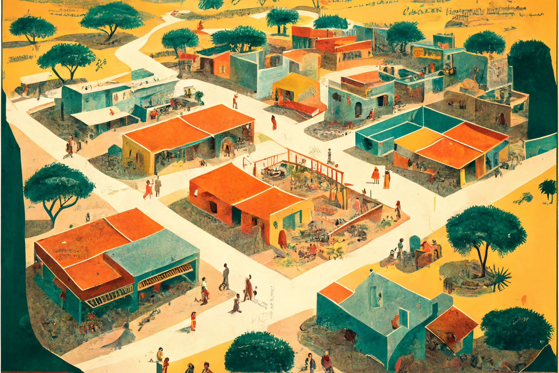
10 km2 Progress Survey Concept: Ten countries, ten locations, surveyed ten years apart.
In the summer of 2013, The Atlantic published a page entitled "26 Years of Growth: Shanghai Then and Now," which contrasted two images of Shanghai's Financial District, one taken in 1987, and the other in 2013. In the 26 years separating these two photographs, life, business, and wealth in Shanghai were transformed dramatically. As astonishing as this transformation in these two images is, it doesn’t convey how the living standards of the average Chinese changed over those 31 years. The image doesn’t reveal how the lives of the country’s poor improved over that period. Did their roads improve? Did their homes improve? Are there now more shops close to their home, or more places of work?
The 10km2 Progress Survey would look at ten different individual square kilometre blocks of land within villages and towns of ten different low and middle-income countries over two surveys separated by a decade.
Each survey would collect a volume of ground and aerial drone images and information about the region's infrastructure and living standards and survey ten families using a methodology similar to Gapminder’s Dollar Street project. Gapminder's Dollar Street adds a human dimension to the data, providing a candid look at how people live across the world at different income levels. While the project has outstanding value, each data sample is a moment in time, and it's difficult to see how the lives of people have changed over time. What's needed is a sample set of Dollar Street style data, but taken now and a decade into the future.
The export after the first complete survey would be ten individual time capsules of living standards containing an enormous fleet of images and data.
The export after the 10th year would be a data set to contrast against the living standards data collected in the first year.
This idea first came to me while reading Norberg’s "Progress," where he writes of a team of photographers who did something similar to this very concept. After reading the following excerpt from the book, I was dumbfounded, thinking, “surely we should do this again.”
“In the 1960s and 1970s the Swedish author Lasse Berg and the photographer Stig Karlsson visited several Asian countries, documenting misery and warning about impending disaster. They had read what the experts had written about a hopeless continent, where they expected to find overpopulation, endless war and famines. They had learned from the economist Gunnar Myrdal, the authority on Asia in those days, that China was too chaotic to function, Malaysia had too much ethnic division and the South Koreans did not have a work ethic because of their religion. Berg and Karlsson saw what they expected to see, and thought that the worst was yet to come: ‘Doomsday was approaching, in one way or the other.’
But in the 1990s they returned to the same places and villages and found a continent of hope. ‘Nothing was the way I had expected,’ Berg writes:
My Asia pulled through. Better clothes, more food, improved security. But above all, this revolution in people’s minds. Where poverty used to be natural (‘my parents were poor, I am poor, my children will be poor – it has always been that way and always will’) it was now considered outrageous, unjust, unsustainable by the poor themselves. It was the same in every country: India, China, Japan, Indonesia, Malaysia, South Korea etc. Less poverty, rapidly increasing life expectancy, greater openness, freedom and knowledge. Things had turned out much better than I thought possible.
In India they found that even the poorest villages no longer smelled of urine and faeces, and mud huts had started to be replaced by brick buildings, keeping the heat in and the insects out. They were wired up for electricity and had television sets. When they showed young Indians what things looked like on their last visit, the young people refused to believe it was the same place. Could things really have been that miserable here?”
While researching this concept, I selected a sample of satellite mapping data from the outskirts of the city of Ruhengeri in northern Rwanda and was amazed by the development over the previous decade. It got me wondering, perhaps Ruhengeri would make an excellent square sample in the progress survey?
So that's it; a shower thought that's been in my head for five years. It's not funded, and there's no methodology built out for the concept yet; it's simply an idea for a long-run progress survey that could return some fascinating data and a unique perspective on the progress of living standards in 2034.
This is great. I'm all for it. To reveal my enthusiasm I am going to throw out some timelines, ideas, and numbers here to keep your creative juices flowing. Feel free to disagree and quibble.
I think I'd definitely want enough data for a basic VR "take a walk in this area" product (for if such things ever become 'a thing'). I'd also scan the area, assuming permission like an archaeological site to make 3-d reconstructions of it simple. Collecting information on professions and income would also be helpful in the ten year comparison.
Some random thoughts.
Hey mate, thank you kindly for the comment. With a budget of $100k, you could certainly do a lot. The team at Gapminder put together a data collection package for their Dollar Street project, which is an excellent basic starting point. A few interesting developments from the last post, 1. I submitted an O’Shaughnessy Fellowship application to dedicate a year to progress studies, and 2. I was offered a possible opportunity by a friend and coworker to receive some ground support via himself and his family in Rwanda, possibly in June of 2023, opening a window to secure block 1/10 or run a pilot block 0/10 test.
Some of the data collection points I had in mind were,
In post-production, the census, drone, and satellite data could be used to calculate increases in structure density, etc. I already tested this for the Rwanda block and found that structure density doubled while the quality, particularly for roofing materials, increased dramatically.
Happy to keep bouncing ideas; it's a great project that's worth, if nothing else, continuing to talk about.